Twin Cities Transit History Map
Oh the places you'll go...
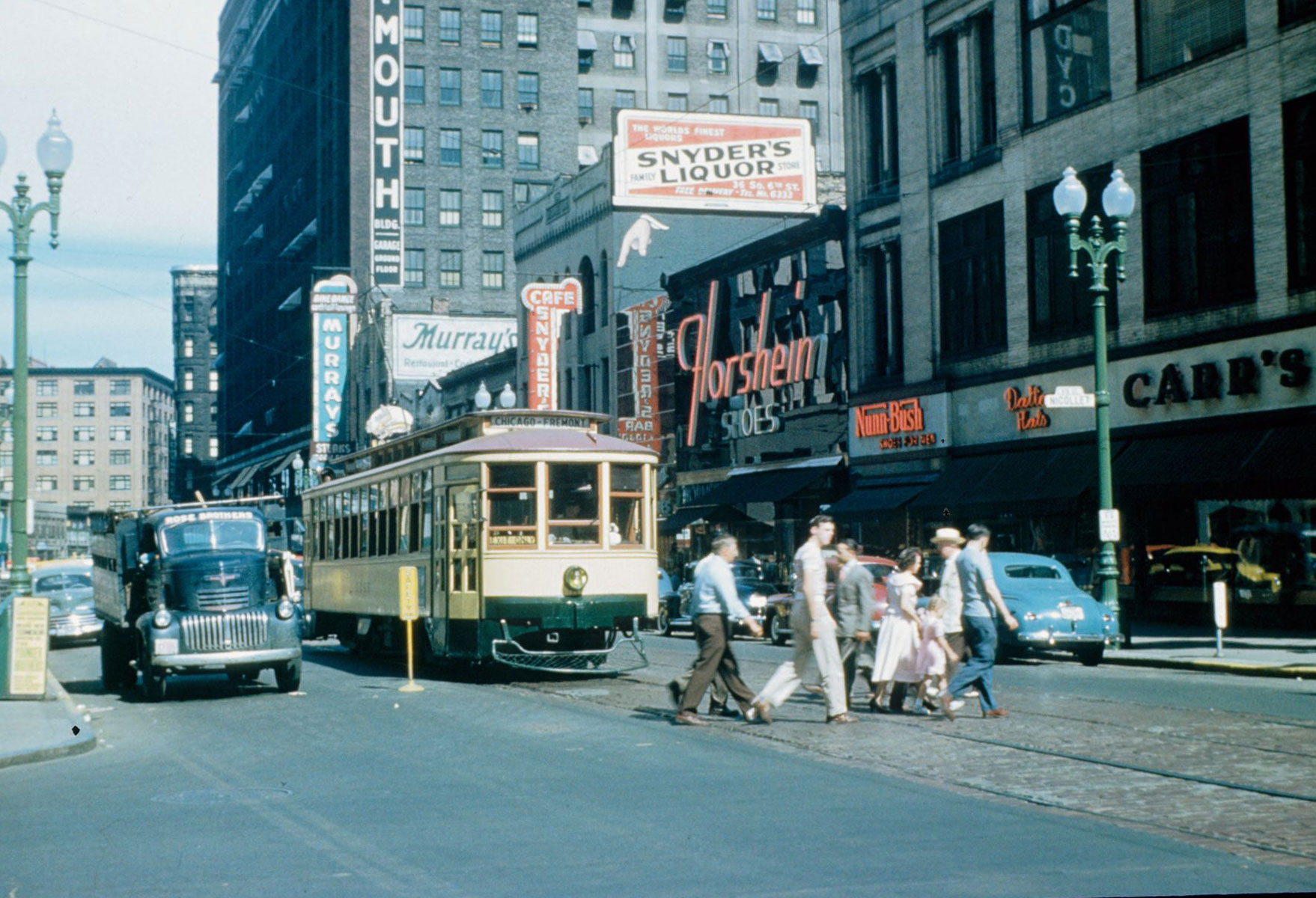
This map is an exploration of Minnesota transportation history focused on the state's major urban center the Twin Cities of Minneapolis and St. Paul. The early Twin Cities transit system began in 1889 with the first horse-driven trolleys and steam powered trains, and peaked in the 1950s with modern electric streetcars and motorized buses. The famous streetcar system, and expansion of the city grid was pioneered by magnate Thomas Lowry and the Twin City Rapid Transit (TCRT) Company.
The modern Metro Transit bus and light rail system still follows many of these routes through cities, neighborhoods and major streets. Use this map to explore where streetcars roamed past homes and defined the city we see today.
Attribution
I have to initially thank Chris Arvin's popular San Francisco trolley map for spurring the creation of a Twin Cities version. This project has gone through various starts and stops as it contains many difficult and time-consuming pieces to put together. It's arrival to a first version must thank my friend transit enthusiast Brian Long and the ultimate Minnesota historian on all things streetcar Aaron Isaacs.
- Twin Cities by Trolley - The Streetcar Era in Minneapolis and St. Paul by Aaron Isaacs and John Diers
- Brian Long, Aaron Isaacs, and the Minnesota Streetcar Museum
- Metropolitan Council Agency Data - Historic Transit Routes
- "Where the San Francisco Streetcars Used to Go" by Chris Arvin
There is a future wishlist for this map and I am very open to comments and encouragement.I am also seeking more personal stories about the streetcar system from first-hand accounts before we lose that generation.